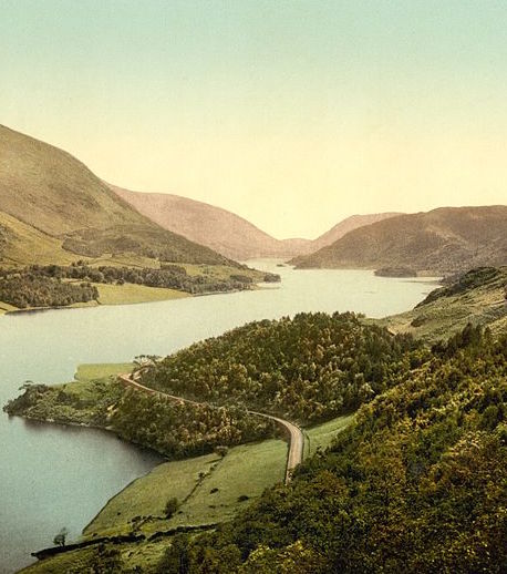
Image: Thirlmere Reservoir, Cumbria, owned by United Utilities – Wikimedia Commons
Updated 13th December to include freshly acquired figures on acreages. Updated 28th September to include details for Wessex Water.
When you turn on a tap, brush your teeth or flush the loo, probably the last thing on your mind is where that water comes from or is going to. Clean running water and sewerage systems are the unsung underpinnings of civilisation. But collecting, storing and cleaning all that water requires a lot of land; and today, in England, that land is owned by 9 companies.
In 1989, the Thatcher government privatised the water industry, selling off the 9 English regional water authorities to private firms. These firms have continued to operate as monopoly service providers in these regions – you can’t actually switch supplier – so you might ask why the industry was ever privatised.
The table below lists the water utilities serving England, what’s known about the landholdings they own, and what public farm subsidies they claim under the Common Agricultural Policy (CAP) for managing their land:
| Water company | Land holdings (acres) | CAP payments 2015 | Source / notes |
| United Utilities | 141,000 | £77,712 | Landholdings: http://corporate.unitedutilities.com/media-press-questions.aspx
CAP payments from two separate entries combined. |
| Yorkshire Water | 70,000 | £51,992 | Landholdings: https://www.yorkshirewater.com/partner |
| Thames Water | 16,000 | £0 | Landholdings: http://www.thameswater.co.uk/about-us/5870.htm |
| Anglian Water | 17,789 | £45,763 | Landholdings: my calculation using GIS map released to me (see below) |
| Northumbrian Water |
21,032 |
£0 | FOI response from Land Registry (see The 50 companies that own over a million acres) |
| Severn Trent Water |
51,668 |
£575,582 | FOI response from Land Registry (see The 50 companies that own over a million acres) |
| South West Water |
15,816 |
£35,524 | FOI response from Land Registry (see The 50 companies that own over a million acres) |
| Southern Water | 5,506 | £0 | FOI response from Land Registry. |
| Wessex Water | 7,166 | £0 | FOI response from Wessex Water. |
| Totals | 345,977 acres | £786,573 | A small number of other private companies also supply water only or sewerage only for smaller areas; these nine firms supply both water and sewerage services and are the major suppliers for each region |
Adding in the 77,975 acres owned by Welsh Water gives a total for all 10 water utilities of England and Wales of 423,952 acres.
The enduring sense that water is a public asset has lent weight to calls for water companies to be more open and transparent. In 2015, a remarkable legal case brought by the law firm Fish Legal resulted in a ruling that all water utilities had to be subject to the EU-mandated Environmental Information Regulations (EIRs). EIR requests are a little-known but very useful means by which people can request environmental information from public bodies – and now also from water companies.
I decided to put the Fish Legal ruling to the test with an EIR request to all the English water companies, asking them to release digital maps of the land they own. Water companies’ responses have been, to put it mildly, mixed.
I think it’s fair to say that some of the water firms have been… a little put out at the sudden obligation to answer environmental information requests from the public. Whilst all the water companies now have sections on their websites about the EIRs, some have not exactly made it easy to submit a request. South West Water’s online request form was broken when I tried to use it, and another company’s form would only let me request information about my water bill (though they got back to me quickly on Twitter to supply an email contact).
More disappointing has been the sort of responses I’ve had. Severn Trent Water, for example, refused to answer my request on grounds that “Details of land ownership is not environmental information under the Regulations”.
This is nonsense. If ‘land’ is not environmental, what is? Where a water company owns land has potentially major repercussions for the quantity and quality of water in the surrounding environment. Some of the water firms have also expressed an interest in using their extensive landholdings for other activities with big environmental implications – for instance, United Utilities are considering opportunities for fracking on their land. Others, like Yorkshire Water, have started to use their upstream landholdings for experiments in natural flood management. And Severn Trent Water themselves, as part of the £575,582 of CAP payments they received in 2015, claimed £57,875 for ‘agri-environment-climate’ schemes on their land. For all these reasons, land ownership maps are surely ‘environmental information’ and fall under the scope of the EIRs. Indeed, other companies agreed with my definition.
Northumbrian Water had a different reason for refusing my request: the information, it claimed, was already publicly available via the Land Registry. This isn’t true, as I pointed out when appealing their refusal; not unless you define ‘publicly available’ as meaning ‘pay £3 for each and every single land title and boundary outline’, for potentially thousands of land parcels.
A third category of refusal came from Southern Water: they claimed that my request was both “manifestly unreasonable”, and that, anyway, “the request relates to material which is still in the course of completion”. While I like to think of myself as a bit of a troublemaker, I didn’t think my inquiry was unreasonable, manifestly or not. But I suspect this was simply cover for the real reason: the state of the company’s records. As they went on to explain:
“Our definitive land ownership records are held in deed packets. Whilst we have attempted to put this information in digital format for internal use, the digital information is incomplete. To provide a definitive digitized map of our land ownership would be manifestly unreasonable and the cost of complying with this request would be too great.”
It seems a bit odd that in 2016, a major company continues to rely on paper records to know what land it owns and manages.
At the time of writing, United Utilities and Yorkshire Water have yet to send final responses, having taken out 20-day extensions on top of the original 20-working-day limit on replying. I’ll update this post once they’ve got back to me. UPDATE, 6th September 2016: both companies have now responded – and both have refused my request, claiming land ownership is not environmental information. Yorkshire Water also claim that disclosure of such data should be exempt on ‘national security grounds’…
But three out of the nine water companies have answered my request – one in full. Thames Water were the first to get back to me, and took the time to discuss my request over the phone. They wouldn’t be able to give me access to a full GIS map of their landholdings, they stated, given restrictive licensing conditions on their maps. (I’m inclined to believe them, as their maps may well contain information licensed by Ordnance Survey, the “vampire squid wrapped around the face of UK public-interest techology”, as one mapping guru puts it.) But they could send me a spreadsheet listing all landholdings, with point-location data. That would be a good start, I said; and here are the results plotted as a Google Map:
Wessex Water, who I sent my information request to a bit later, got back to me on 28th September with a partial but still helpful reply. They accepted that some of the information I’d asked for counted as ‘environmental’ under the EIRs but refused to disclose a full GIS map on grounds of national security. However, they did disclose that they own some 7,166 acres, and sent me a PDF map of their landholdings:
Map of Wessex Water landholdings
But the prize for the water company who have proven as transparent as the water they supply goes to Anglian Water. They didn’t look to be winners first off; in fact, they started out with the same excuse used by Southern Water, saying that they only held paper maps of the land they owned. But to my surprise, they went away and bought the data and promptly sent me the lot for free and without any stated licensing. So here they are, Anglian Water’s landholdings, all 17,889 acres of them, scattered across the East of England – from the smallest local water treatment plant to the great expanse of Rutland Water: Map of Anglian Water’s land (Google Fusion Table map)


To sum up. With water companies now subject to the Environmental Information Regulations, a major first step has been taken towards opening up one of the privatised industries of the 1980s to the light of public scrutiny.
Yet as the mixed responses to my information request show, there is still a way to go for this to percolate down into the industry’s culture. Some may argue that only re-nationalisation can secure real accountability; but public ownership by itself is no automatic guarantor of greater transparency if there is no respect for service-users. Water firms should embrace open data as part of good customer service. And they should also do so because, as managers of a vital national resource, owners of 345,977 acres of our land and recipients of £786k/yr in taxpayer subsidies, they have a public duty to be open. However they get there, we need water companies to be transparent. After all, no-one likes cloudy water.

Reblogged this on sideshowtog.
LikeLike
Hi Guy, thanks a lot for this really great investigation. This information could be extremely useful, for example by helping communities identify land they might be able to get access to. I think this would be a great model for further work.
I don’t think the OS’s restrictive licensing conditions are insurmountable in this case. For starters you could map the Thames Water sites onto the Land Reg INSPIRE polygons. Even if OS stop this, I wonder if you could find another way to map the sites – maybe with OpenStreetMap polygons, or (with help) by retracing the boundaries.
I think your approach is worthy of further energies, including expanding the requests to other utilities (transport/ electricity), using FOI. I wonder if approaches based on a carrot (CSR) might be more effective than what some are clearly perceiving as a stick (EIRs). If they can be convinced of the benefits maybe they would compile/ release the data? Either way it would be great to get this data out there.
LikeLike
Thanks, Tom! Let’s chat further about INSPIRE licensing, as I was fairly sure that the OS licence restricts reproduction of this in any useful way…
Definitely worth expanding the approach to other utilities – I’ve got maps of Network Rail land now which I’ll blog about in future (though it’s pretty much as you’d expect from the organisation name!).
Incidentally, in case anyone wants to submit EIR requests to the water companies, here are contact details (email addresses or online forms):
United Utilities – EIRRequests@uuplc.co.uk
Thames Water – eir.requests@thameswater.co.uk
Northumbrian Water – https://www.nwl.co.uk/your-home/environment/environment-query.aspx
Yorkshire Water – documentmanagement@loop.co.uk
Anglian Water – EIR@anglianwater.co.uk
Severn Trent Water – http://severntrentwater.custhelp.com/app/ask/session/L3RpbWUvMTQ2ODE4MzA3MC9zaWQvSG1JOFBiVm0%3D
South West Water – http://southwestwater.custhelp.com/app/general_enquiry
Southern Water – customerservices@southernwater.co.uk
Wessex Water – env.info@wessexwater.co.uk
LikeLike
Interesting postscript on Southern Water: they have been very responsive in my local area to a request from a community group to use some of its land, a former allotments space unmanaged for many years, for community food-growing and setting up a community apiary. Glad to report that is working like a dream. Shows what can be done if water companies are responsive to community needs!
LikeLike
Hi Andy, thanks for this! That’s great to hear, and good on them. Another good reason for water companies (and for that matter, any other landowners) to make available maps of their entire landholdings – so that communities everywhere can approach the owner to ask if they might make use of some underused land.
Just a thought – wonder if it’s worth the community group asking Southern Water for a map of their landholdings, even if simply for the locale/ region?
LikeLike
Hello Guy
Fascinating stuff. Thanks.
The Committee on Climate Change is doing some work on land use modelling – https://www.theccc.org.uk/publication/adas-for-ccc-uk-land-use-projections-and-implications-for-mitigation-and-adaptation/
I think they may need data on land ownership. Not sure where they would get it from.
One thought on the question of public vs private ownership: What really matters, in addition to transparency, is how land is managed and used. The principle is already well established that land ownership is not absolute – wider society has a stake and a say in land use. For example no-one can build on green belt land. The right to roam is another example.
LikeLike
May be worth another go citing southern waters response and suggesting that you are prepared to ask the Information Commissioner to look into the matter. https://ico.org.uk
I don’t know how gis savy you are but try asking for the shape files and not the underlying os data (although that excuse stinks as the os licence afaik relates to reproduction only, so sending you a copy they have produced under licence shouldn’t be a problem as long as you don’t reproduce it)
LikeLike
When we look at Brexit, we should assess the agreed amount and then divide the cost between all the Euoropean countries which actually own England, Scotland, Wales and Northern Ireland. This assessment should also include the foreign ownership of the Railways, Electricity, Gas.
LikeLike
How the hell do these companies actually own the land? Surely it’s public land from when it was a public service?
LikeLike